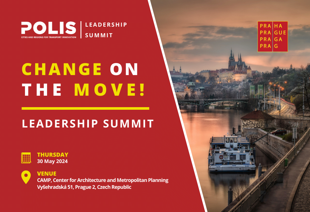
Political Leaders chart the future of mobility at POLIS Political Group meeting in Prague
The POLIS Political Group Meeting of 31 May 2024 assembled in the historic setting of the Lord Mayor’s Residence in Prague, bringing together top political figures from across Europe to address pressing urban mobility challenges and share innovative strategies for sustainable transport.
The event kicked off with a welcome address by Bohuslav Svoboda, Mayor of Prague, who highlighted the city's ambitious plans to invest billions of euros in enhancing its public transport system, cycling, and pedestrian infrastructure. This set the tone for the day’s discussions centred around the theme 'Making it Happen!', where participants explored how cities can effectively plan and execute significant transport investments.
Zdeněk Hřib, Deputy Mayor for Transport and Mobility of Prague, detailed the city’s forward-looking transport strategies in his opening words. Hřib specified the thorough planning process behind Prague’s upcoming transport investments and emphasised the importance of integrating public transport into new residential developments.
'It is not just about investments; the real challenge lies in the "soft projects." We need to shape traffic in cities through means other than investments, such as implementing regulations like setting parking prices in the streets and transit regulations in the historical centre. Topics that are often contentious in public debates. But we should focus on data to base our decisions on facts, not just on opinions.' - Zdeněk Hřib
Karen Vancluysen, Secretary General of POLIS, underscored the critical role of political leadership in driving these transformative projects. 'The collaboration and exchange of experiences among city leaders are pivotal in overcoming common challenges and achieving our shared goals for urban mobility,' Vancluysen stated.
Moving Prague to the Future
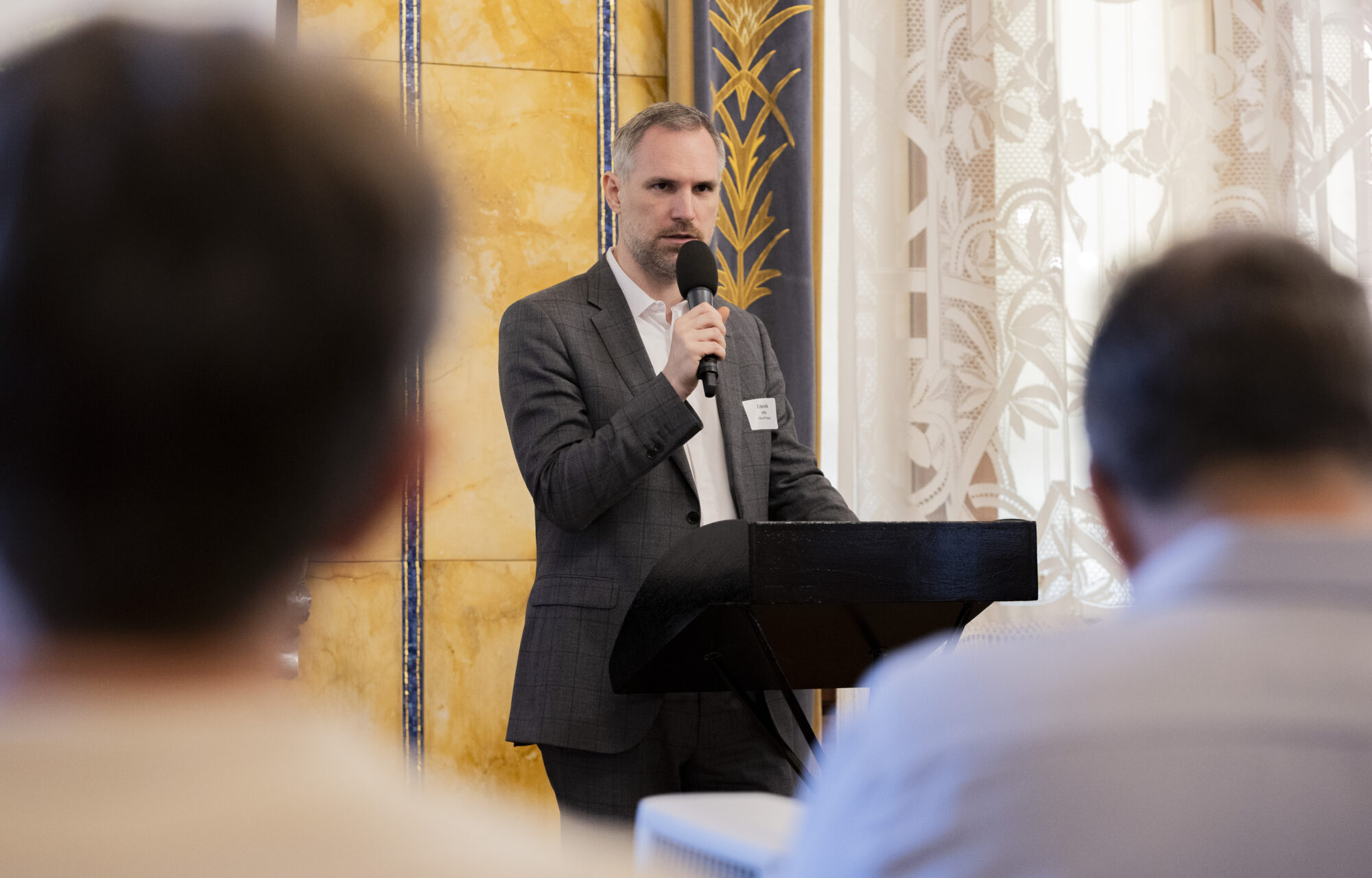
Zdeněk Hřib, Deputy Mayor for Transport and Mobility of Prague - Credit: Tilenfoto
Prague’s mobility network must accommodate the 1.8 million people who come to the city to live, work, study, and visit. With regard to accommodating vehicular traffic, the city boasts a robust paid parking system in the centre, providing a solid foundation for mobility management. 'Discussing pricing strategies is one of the most effective ways of moderating mobility,' said Marek Zděradička, Deputy Director of the Prague Institute of Planning and Development. ‘We can also proudly say that the city has a strong electric transport network in its modal split, with two-thirds of public transport being electric, and we are working hard to develop our cycling infrastructure. Unfortunately, however, this has not changed the fact that the number of cars in the city is steadily growing.’
Looking ahead, Prague's mobility plan emphasises a new transport policy that prioritises public transport, while active modes that promote livability such as biking and walking are also a top priority. However, although the city’s transport network is comprehensive, commuters still face a number of challenges, including a lack of infrastructure for commuting by rail. Mobility planning for the city must also consider national-level infrastructure projects, which include state roads, motorways, high-speed railways, and others.
The city has several major transport projects underway. A new metro line to expand the existing metro system has been planned, and a combined trolleybus system, which replaces diesel buses with those that combine the technology of e-buses and trolleybuses, has been introduced to enhance service to several areas, including the airport. The city also aims to extend the existing tram network to the suburbs and create a cohesive tram ring for better connectivity throughout the city. Prioritising these projects is crucial for improving the transport system.
In addition, a multimodal terminal is currently under construction to integrate multiple transport modes into one, seamless system. This terminal will significantly improve travel efficiency and convenience for residents and visitors alike.
The first pillar of a new residential area must be a bus stop pole!
Klaas Ruitenberg, Deputy for Accessibility, Public Transport, Infrastructure, Cycling, and Road Safety of the Province of Gelderland, contributed insights on financing public transport infrastructure in expanding residential areas.
'The major expansion of the housing supply in our region is both necessary and imminent. A large number of homes are being built to ensure that everyone has access to housing and can easily travel to work or school, visit friends, and enjoy recreational activities. However, this expansion poses risks to our mobility systems. The projected increase in trips resulting from additional homes threatens to overwhelm our already critical transport networks.' - Klaas Ruitenberg
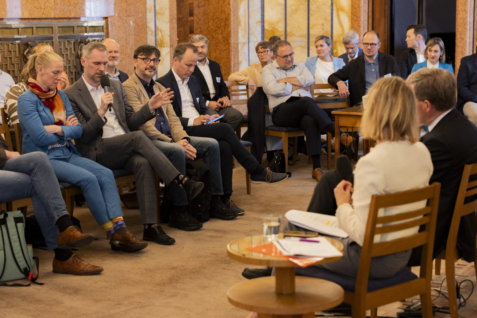
Participants actively engaged in the discussion - Credit: Tilenfoto
The region recognises an urgent need for change. The current bicycle connections, public transport, and roads cannot cope with the anticipated increase in travel demand. Thus making it clear that there is a crucial link between spatial development and accessibility, particularly when it comes to housing, economic development, and changes in rural areas. Mobility must be a cornerstone of spatial planning to prevent network gridlock.
When planning for mobility, it will be key to assess what is required to make new homes accessible. Gelderland’s focus is on enhancing public transport and promoting active mobility, such as walking and cycling. New residential areas must be well-served by public transport. However, financing this expansion remains a significant challenge, given rising costs for staff and energy, while budgets remain insufficient. This puts public transport in Gelderland under considerable pressure.
To address this, the province is developing a shared strategy. Their primary approach is to support public transport by building homes around mobility hubs. Spatial plans should prioritise construction in locations that are already - or can be made easily - accessible. The aim is for as much development as possible to occur near public transport and within easy reach by bicycle.
An example of this strategy in action is Nijmegen, where new housing is concentrated around mobility hubs. By building existing centres and cities, the city creates proximity between living, working, and essential services, which reduces the number of trips required.
'It is crucial that working and living areas remain or are made accessible by cycling paths, public transport, and roads. Ensuring accessibility before construction begins is a priority. Typically, we develop residential or work locations first and then address accessibility, such as by adding new bus lines. Now, we must reverse this process and ensure accessibility is arranged before construction starts. The first pillar of any new residential area must be a bus stop,' Ruitenberg concluded.
Harnessing data for policy goals
A significant portion of the meeting focused on the utilisation of digital data to inform and support transport policy. Experts including Sarah-Jayne Williams from Google and Andrew Glass Hastings from the Open Mobility Foundation discussed how data management is becoming as crucial as physical infrastructure management. The session stressed the benefits of data sharing, collaboration with the private sector, and compliance with EU regulations.
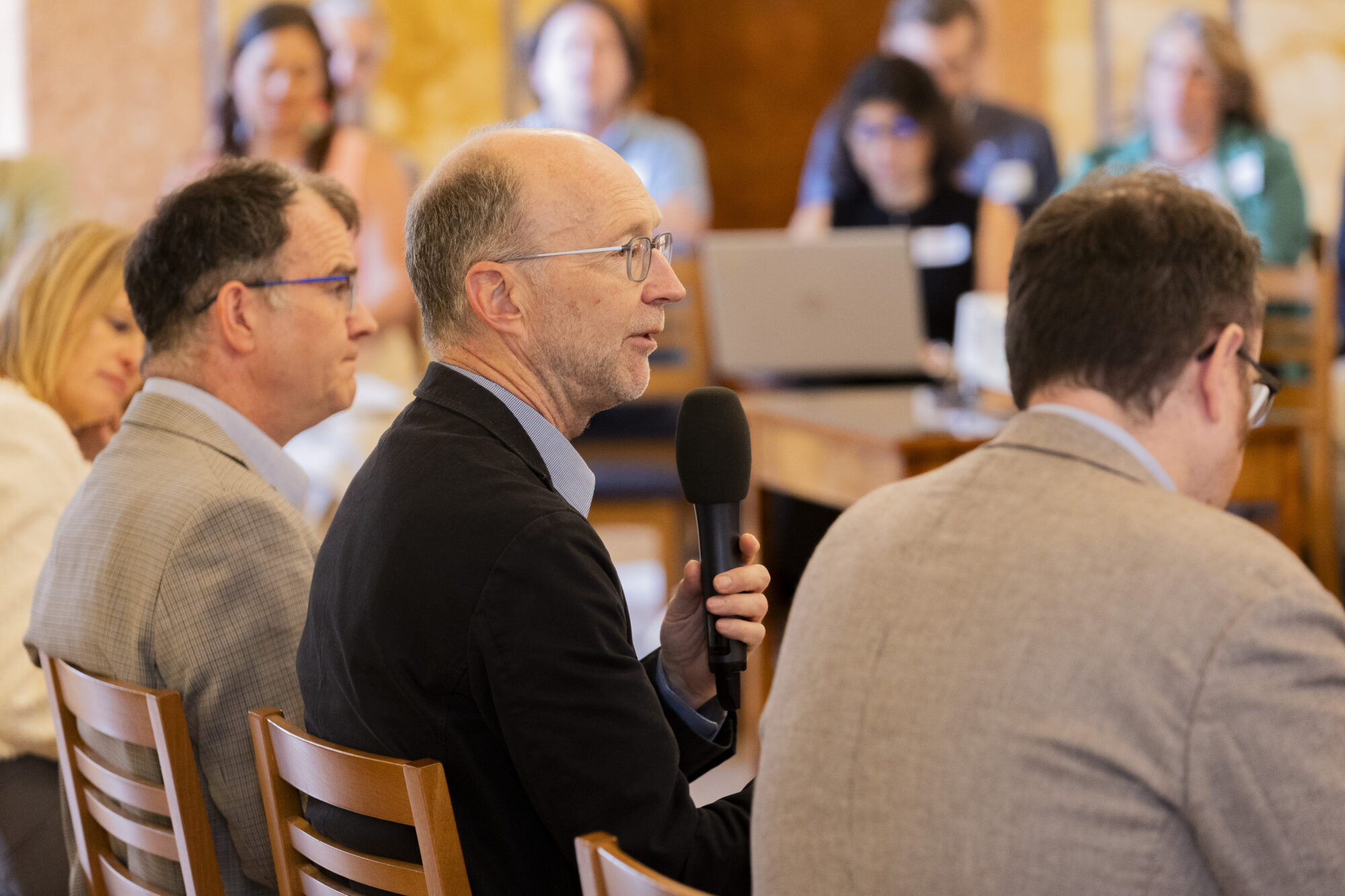
Andrew Glass Hastings emphasised the importance of collecting and understanding mobility data, particularly regarding shared mobility services such as electric scooters, bikes, and future autonomous vehicles. By focusing on vehicle data rather than personal data, privacy concerns are addressed, ensuring GDPR compliance. This data is crucial for planning, managing, and regulating urban mobility systems. It allows cities to understand where trips start and end, enforce compliance with regulations like designated parking zones, and create effective management strategies. Data sharing should be seamless, utilising APIs to enable real-time communication between systems, similar to how online services facilitate comparisons and transactions.
'Planning, management and compliance are fundamental in creating your city’s mobility system. How can you plan your system if you don’t understand the trips happening on your streets?' – Andrew Glass Hastings

Sarah-Jayne Williams, Director of Geo Product Partnerships, Google addressing data sharing with cities and regions - Credit: Tilenfoto
In 2017, Google began collaborating with cities and regions to integrate transit data into its maps, creating the Google Transit Specification Format, which soon became the standard General Transit Specification Format. This standardisation allows for the effective sharing of digital transport data.
Google's data priorities include using imagery from satellites, street-level, and aerial sources to provide essential information on maps. However, for real-time data like street signs, road signs, cycle lanes, and incidents, Google relies on city partners and transit agencies.
'This partnership is crucial to encouraging users to choose greener, time-efficient routes, as accurate and up-to-date information is essential for building trust and driving long-term behavioural change,' says Sarah-Jayne Williams.
Google also aids cities by improving data quality and sharing valuable insights with transit agencies, helping with urban planning and climate action plans. Initiatives like the GreenLight tool aim to optimise traffic light operations to reduce emissions and journey times. Through these efforts, Google is committed to advancing sustainable and smart mobility in collaboration with cities and regions.
Deputy Mayor Zdeněk Hřib focused on the importance of the European Mobility Data Space (EMDS), a vision that has been operational for some time. EMDS serves as a marketplace where parties can exchange and share data, aiming to be a trustworthy platform. Cities and regions play dual roles: they are both consumers and significant producers of data. For instance, Prague, which owns a public transport company, has created an open data platform using Waze feeds amongst others to process and publish travel intervals on specific roads. This open-source platform can be utilised by any city, allowing users to track travel time variations throughout the week and year. The discussion now extends to the Committee of Regions, focusing on how EMDS can best serve not only capital cities but also rural, coastal, and suburban regions.
Sustainable Urban Mobility Plans (SUMPs)
The importance of SUMPs was a central theme in the latter part of the meeting. These plans are essential for setting clear mobility goals, facilitating stakeholder engagement, and ensuring policy continuity. Matthew Baldwin, Deputy Director General of DG Energy at the European Commission, and Paul Riley from the European Investment Bank, among others, shared their experiences and advice on developing and implementing effective SUMPs. This session allowed political leaders to exchange ideas on how to leverage SUMPs to meet both local and EU-wide mobility objectives.
Matthew Baldwin, Deputy Director General - DG Energy, European Commission on SUMPs - Credit: Tilenfoto
Looking Ahead
In her closing remarks, Karen Vancluysen reiterated the importance of ongoing collaboration and invited participants to the next POLIS event in Karlsruhe, Germany, later this year.
This year's meeting once again demonstrated POLIS's commitment to supporting cities and regions in their journey towards innovative and sustainable urban mobility solutions, ensuring a collaborative approach to the future of transport across Europe.

- Related Events
- Related Members